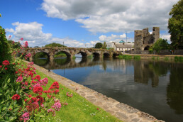
The Barrow Way, Co. Carlow
Rising in the Slieve Bloom Mountains in the southern midlands, and joining the rivers Nore and Suir, before flowing into the Celtic Sea at Waterford Harbour, the River Barrow lays claim to being the second longest river in Ireland.
First made navigable in the eighteenth century, the Barrow stretches for 114km from the canal hamlet of Lowtown in County Kildare to the beautiful monastic site and village of St Mullins in south County Carlow.
With its peaceful route through a quiet landscape, a constantly expanding river for company, and grassy towpaths, tracks and quiet roads, the Barrow Way is perhaps one of the most peaceful walks in Ireland.
Type of Walk: National Waymarked Trail
Level of Difficulty: An easy walk
Length: 100km
Start Grid Point: N 790 250
Finish Grid Point: S 728 378
Ordnance Survey Map: OSI Discovery Series Sheets 49, 55, 61 and 68
You can read more about walking The Barrow Way at Irishtrails.ie.